
Ferry Roads
Known locally as the “ferry roads,” these historic roads provided access to the Stanislaus River ferries and the diggings from, first, the Old Antelope Trail and the later Reed’s Turnpike, constructed after the copper boom in the early 1860s.
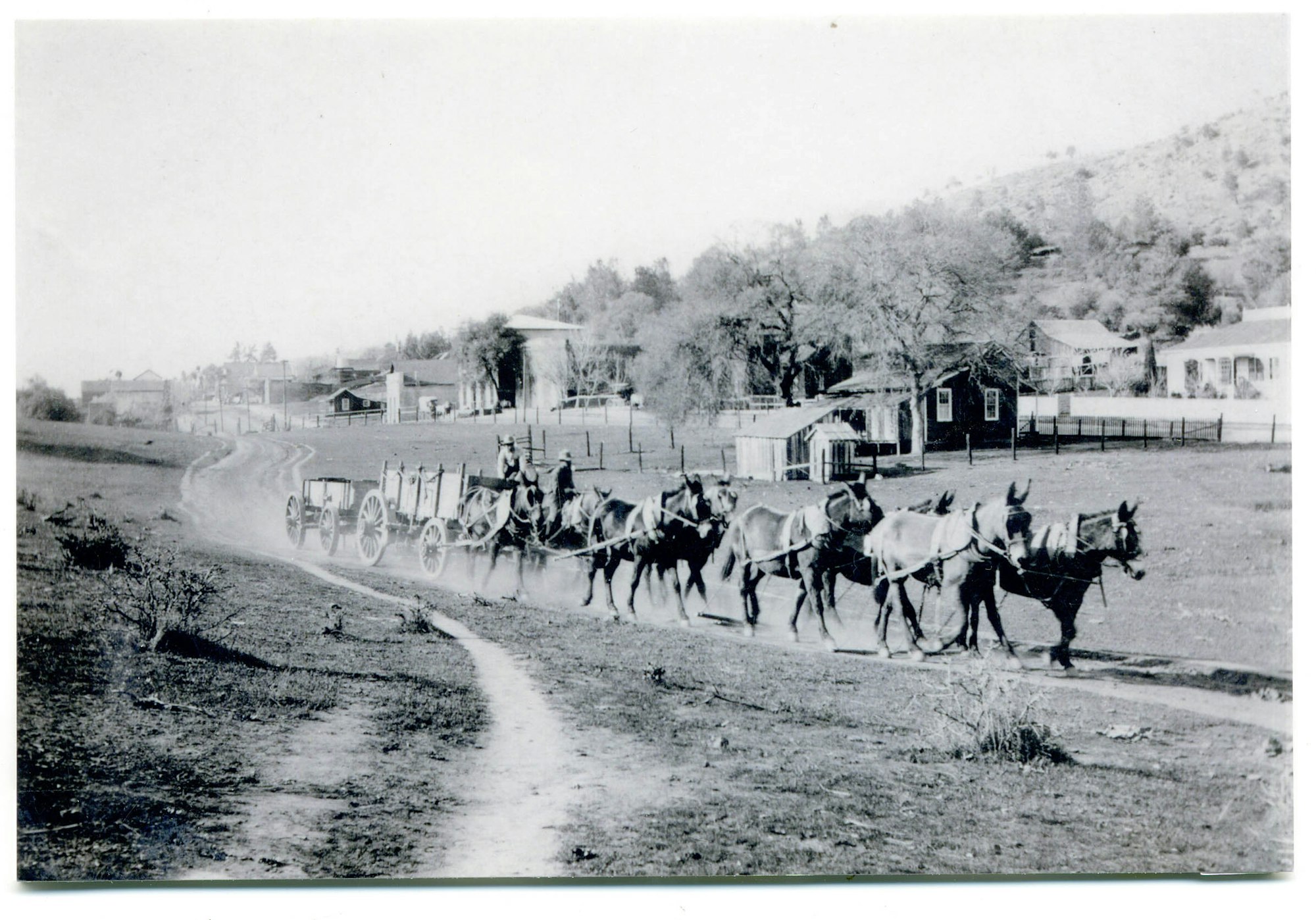
Three historic roads, with various permutations over the years, were established to provide access to the O’Byrnes Ferry crossing from the Calaveras side of the river (Figure XXX). The routes of these roads, and their names, changed over the years as they were superseded by other roads, other connections, and other starting points. Their destinations, however, were always O’Byrnes Ferry and either Knights Ferry or Sonora. Thus, all of the roads were known at various times as the Burns Ferry, Old Burns Ferry, O’Byrnes Ferry, Six Mile Bar, Copperopolis to Knights Ferry, or Sonora roads. Other roads connected from these roads to various ranches, and between ranches, or provided shortcuts from the ranches to Knights Ferry (i.e. Smith Flat Road). Therefore, the discussion below is provided only as a general reference to the more important routes.
The earliest road, which turned south from Thomas McCarty’s Log Cabin Ranch (Section 8, T1N. R12E) on the Stockton Road (present Highway 4), was also known as the Sonora Road. When the citizens petitioned the Board of Supervisors to establish a new road to Reynolds Ferry, the account noted that it intersected the Burns (sic O’Byrnes) Ferry Road at the Log Cabin (Calaveras County Road Records:261).
In 1859 the citizens of Scorpion Gulch petitioned the Calaveras County Board of Supervisors for “a road from McCarty’s cabin, Scorpion Gulch to Six Mile Bar” (about one and one-half miles downstream from Scorpion Gulch, at site of later Goodwin Dam) (San Andreas Independent, November 26, 1859). The following year the road from Scorpion Gulch to Log Cabin was noted as the main road, and at times was noted as the Six Mile Bar Road, but by 1870 this road was depicted on a map as the “Old Burns Ferry Road” (GLO 1870). A segment of a branch of this road was recorded as (CA-CAL-1868H).
The “Upper Road” to O’Byrnes Ferry was established in February of 1857, although undoubtedly in use before that date (Calaveras County Road Record Book:262). The citizens’ petition for a county road to O’Byrnes Ferry and vicinity was granted the following February (San Andreas Independent, February 20, 1858). This road departed from the Stockton Road near the Four Springs Ranch (present junction of Highway 4 and Reed’s Turnpike) and continued southeasterly through the Moulton Ranch to connect with O’Byrnes Ferry (TH-2). It follows the approximate route of Littlejohn Road today.
Two other roads, depicted as “Old Burns Ferry” and “Burns Ferry Road” on an 1870 map appear to have been variations or permutations of these more important routes (GLO 1870).
After the discovery of copper and the development of Copperopolis, which became the supply center for southwestern Calaveras County, a route was established which coursed southeasterly from the town to connect with the ferry crossing at O’Byrnes. This route superseded the earlier O’Byrnes Ferry roads, which were soon abandoned except for local traffic (GLO 1870, USGS 1916). This main route crossed the Stanislaus River and proceeded easterly through Tuolumne County to connect with the road from Knights Ferry to Sonora (present Highway 108) near Yosemite Junction. It then proceeded northwards through Mountain Pass to Jamestown and Sonora. It is known today as O’Byrnes Ferry Road.
The Copperopolis and Knights Ferry Road ran for some distance easterly from Knights Ferry along the north bank of the Stanislaus River, before climbing out to the undulating hills of the old Rancheria, past Scorpion Gulch. From there it turned northerly through Ramsey Flat and into Copperopolis (GLO 1870, USGS 1916, Criswell 1972). This route was undoubtedly a more direct route from Copperopolis to Knights Ferry than the O’Byrnes Ferry route, and was also used by those at the Alto Mine and the Moulton Ranch.
The Smith Flat Road provided access between the O’Byrnes Ferry roads through Smith Flat to Knights Ferry. Although it traverses more geographically difficult terrain than the Copperopolis and Knights Ferry Road noted above, it undoubtedly served the ranches along its route and provided a more direct access for those ranches in the upper Littlejohns Creek region.
Other roads within the area connected the various ferry roads with each other, and with the local ranches. One of these, (TH-3) was depicted in a 1901 map and appears to date to that era.
By Judith Marvin, November 2001.
References
Beauvais, A.B.
1882 Map of the County of Tuolumne. Tuolumne County Recorder’s Office, Sonora, California.
Bishop, Frances
n.d. Stanislaus River Ferries. Notes on file, Calaveras County Archives, San Andreas, California.
Borthwick, J.D. (index and foreword by Joseph A. Sullivan)
1857 3 Years in California. Reprinted by Biobooks, Oakland.
Brotherton, I.N. “Jack”
1982 Annals of Stanislaus County. Volume I, River Towns and Ferries. Western Tanager Press, Santa Cruz.
Calaveras, County of
Land Claim Books
Homestead Books
Deed Books
Mining Claim Books
Water Right Books
Assessment Rolls
Great Register of Voters Lists
Vital Statistics
Probate Records
Articles of Association
Mechanics Lien Books
Books of Agreements
Minutes of the Court of Sessions
Calaveras Chronicle
var. Calaveras Chronicle, San Andreas. On file, Calaveras County Archives, San Andreas, California.
Calaveras County Historical Society
1986 An Album of the Pioneer Schools of Calaveras County. Calaveras County Historical Society, San Andreas, California.
Chispa
var. The Quarterly Bulletin of the Tuolumne County Historical Society, Sonora, California.
Clark, William B., and Philip A. Lydon
1962 Mine and Mineral Resources of Calaveras County, California. California Division of Mines and Geology County Report Number 2. California Division of Mines and Geology, San Francisco.
Columbia Gazette
var. Columbia Gazette, various issues.
Cunningham (Marvin), Judith
1988 Historical Report on the Spicer Ranch and Rancho del Rio Estanislao for the Proposed Copper Cove Effluent Disposal Pond. Prepared for Davis-King & Associates, Standard, California, for submittal to Calaveras County Water District, San Andreas, California.
Davis-King, Shelly, and Judith Marvin
1990 Black Creek Estates and Golf Resort Cultural Resources Reconnaissance. Submitted to Mother Lode Engineering, Altaville, California.
1994 Contextual History of Tuolumne County. Davis-King & Associates, Standard, California and Foothill Resources, Ltd., Murphys, California. Prepared for The County of Tuolumne, Sonora, California.
De Ferrari, Carlo M.
1999 Personal communication of 25 January 1999. Notes on file, Foothill Resources, Ltd., Murphys, California.
Divoll, J.G.
1882 A History of Tuolumne County, California. B.F. Alley, San Francisco. Republished by the Tuolumne County Historical Society, Sonora, California, 1983.
Elliott, W.W.
1885 Calaveras County Illustrated and Described. W. W. Elliott, Oakland, California. Republished by the Calaveras County Historical Society, Valley Publishers, Fresno, 1976.
Farquhar, Francis P.
1930 Up and Down California in 1860-1864, The Journal of William H. Brewer. Yale University Press, New Haven, Connecticut.
Fuller, Willard P., Jr., Judith Marvin, and Julia G. Costello
1996 Madam Felix’s Gold, The Story of the Madam Felix Mining District, Calaveras County, California. Calaveras County Historical Society and Foothill Resources, Ltd., Calaveras County.
Greeley, O.F., Secretary
1901 Illustrated Historical Brochure of Tuolumne County, California. Compiled and Issued by The Progressive Association, Sonora, Tuolumne County, California. Republished by the Tuolumne County Historical Society, Sonora, California, 1999.
Lewis, L. Helen
1968 A History of Copperopolis. Calaveras County Office of Education, San Andreas.
Gudde, E.G.
1969 California Place Names, 3d ed. University of California Press, Berkeley.
1975. California Gold Camps. Edited by E.K. Gudde. University of California Press, Berkeley.
Heckendorn & Wilson
1856 Miners & Business Men’s Directory. Columbia, California. Republished by the Donald I. Segerstrom Memorial Fund, Sonora, California, 1976.
Herbert, Rand F., and R. Meta Bunse
1993 Historic Resource Evaluation Report for the SR-120 Oakdale Bypass Interchange Improvement Project Alternatives 1, 2A, 2B, 2C, and 2D. Postmile: 3.0/14.1, Contract: 10B933, EA: 10-345400. Prepared for Caltrans District 10, Stockton, California, by JRP Historical Consulting Services, Davis, California.
Lang, H.O.
1882 History of Tuolumne County, California. B.F. Alley & Co., San Francisco.
Las Calaveras
var. The Quarterly Bulletin of the Calaveras County Historical Society, San Andreas, California.
Lewis Publishing Company
1892 A Memorial and Biographical History of the Counties of Merced, Stanislaus, Calaveras, Tuolumne and Mariposa, California. The Lewis Publishing Company, Chicago. Facsimile Reproduction published by the McHenry Museum of Art and History, Modesto, California, 1980.
Mace, O’Henry
1991 Between the Rivers, A History of Early Calaveras County. Gold Country Enterprises, Sutter Creek, California, and Cenotto Publications, Jackson, California.
Marvin, Judith
1992 Preliminary Historical Investigations of the Flowers Ranch, Near Copperopolis, Calaveras County, California. Prepared for Archaeological Services, Inc., Stockton, California.
1994 Preliminary Historical Investigations for Three Historic Sites on the Proposed Woodside Partners Project, Near Copperopolis, Calaveras County, California. Prepared for Archaeological Services, Inc., Stockton, California.
1995 Historical Investigations for Three Historic Sites on the Proposed Calaveras Country Club Project Near Copperopolis, Calaveras County, California. Prepared by Foothill Resources, Ltd. for Archaeological Services, Inc., Stockton, California.
Perkins, William (introduction and annotation by Dale L. Morgan & James R. Scobie)
1964. Three Years in California, William Perkins Journal of Life at Sonora, 1849-1852. University of California Press, Berkeley.
Progressive Association of Sonora (O.F. Greeley, Secretary)
1901 Illustrated Historical Brochure of Tuolumne County California. The Progressive Association, Sonora, Tuolumne County, California. Republished by the Tuolumne County Historical Society, 1999.
Ruppel, Margaret Gaylord
1946 El Rancheria del Rio Estanislao, A History. Castle Press, Pasadena, California.
San Andreas Independent
Various issues.
Stewart, Suzanne B.
1991 A Cultural Resources Study for the Bank of San Francisco Copperopolis Project, Calaveras County, California. Prepared for the Bank of San Francisco and Woodside Partners, Archaeological Services, Inc., Stockton, California.
Stoddart, R.R. (Edited and Annotated by Carlo De Ferrari)
1963 Annals of Tuolumne County. Valley Publishers, Fresno, California.
Stone, Rhoda and Charles A.
1991 The Tools are on the Bar. The History of Copperopolis, Calaveras County, California. Rhoda and Charles Stone, Copperopolis, California.
Tinkham, George H.
1921 History of Stanislaus County. History Record Company, Los Angeles.
Tuolumne, County of
Land Claim Books
Homestead Books
Deed Books
Mining Claim Books
Water Right Books
Assessment Rolls
Great Register of Voters Lists
Vital Statistics
Probate Records
Maps
Union Democrat
1909 Tuolumne County California. The Union Democrat, Sonora, California. Republished by the Tuolumne County Historical Society, Sonora, California, 1995.
United States Federal Census
1860 Population Schedule. Calaveras County. Microfilm.
1870 Population Schedule. Calaveras County. Microfilm.
1880 Population Schedule. Calaveras County. Microfilm.
1900 Population Schedule. Calaveras County. Microfilm.
Wood, Richard Coke
1955 Calaveras, The Land of Skulls (Calaveras County). The Mother Lode Press, Sonora, California.